
"Every picture is an idea."
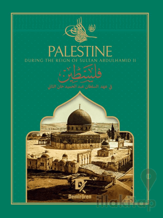
Palestine, referred to by the Ottomans as Land of Palestine (Arz-ı Filistin), is the name of the ancient lands between Egypt, the Mediterranean, and the Jordan River. Throughout the ages, Palestine has been a focal point, a region where people who changed the course of history were born and raised, and for which struggles were fought over its undivided nature. When looking at the photographs in this special album, it will be seen that Palestine is a name for a geography that experienced the last moments of peace and tranquility during the Ottoman period and was developing despite difficulties.
Sultan II. Abdulhamid, who said, "Every picture is an idea," had photographs taken from all corners of the Ottoman geography. Approximately 1,300 pictures of Palestinian cities were examined in the Yıldız Photo Albums, around 400 in the Library of Congress in the USA, and nearly 200 in the New York Public Library. For the region of Palestine, which is considered as a whole without regard to political borders, 293 photographs were selected, particularly emphasizing those with strong expressive power and originality.
Many of these pictures had never been published anywhere before. The book "Palestine During the Reign of Sultan II. Abdulhamid" is divided into sections according to the administrative structure of the early 1900s, including Al-Quds, Yafa, Gaza, and Hebron under the Al-Quds district; Akka, Haifa, Safed, Nazareth, and Tiberias under the Akka district; and Nablus, Bani Sab, Jemmain, and Jenin under the Nablus district. This work presents the geography of Palestine as a whole and is compiled for the first time in a single book.
"Every picture is an idea."
Palestine, referred to by the Ottomans as Land of Palestine (Arz-ı Filistin), is the name of the ancient lands between Egypt, the Mediterranean, and the Jordan River. Throughout the ages, Palestine has been a focal point, a region where people who changed the course of history were born and raised, and for which struggles were fought over its undivided nature. When looking at the photographs in this special album, it will be seen that Palestine is a name for a geography that experienced the last moments of peace and tranquility during the Ottoman period and was developing despite difficulties.
Sultan II. Abdulhamid, who said, "Every picture is an idea," had photographs taken from all corners of the Ottoman geography. Approximately 1,300 pictures of Palestinian cities were examined in the Yıldız Photo Albums, around 400 in the Library of Congress in the USA, and nearly 200 in the New York Public Library. For the region of Palestine, which is considered as a whole without regard to political borders, 293 photographs were selected, particularly emphasizing those with strong expressive power and originality.
Many of these pictures had never been published anywhere before. The book "Palestine During the Reign of Sultan II. Abdulhamid" is divided into sections according to the administrative structure of the early 1900s, including Al-Quds, Yafa, Gaza, and Hebron under the Al-Quds district; Akka, Haifa, Safed, Nazareth, and Tiberias under the Akka district; and Nablus, Bani Sab, Jemmain, and Jenin under the Nablus district. This work presents the geography of Palestine as a whole and is compiled for the first time in a single book.
| Taksit Sayısı | Taksit tutarı | Genel Toplam |
|---|---|---|
| Tek Çekim | 7.623,00 | 7.623,00 |
| 2 | 4.078,31 | 8.156,61 |
| 3 | 2.769,69 | 8.309,07 |
| 6 | 1.461,08 | 8.766,45 |
| 9 | 1.016,40 | 9.147,60 |
| 12 | 800,42 | 9.604,98 |
-
%30İNDİRİM535,00TL 374,50TL
-
%25İNDİRİM390,00TL 292,50TL
-
%22İNDİRİM300,00TL 234,00TL
-
%11İNDİRİM250,00TL 222,50TL
-
%25İNDİRİM40,00TL 30,00TL
 ÖSYM Tıpkı Basım Çıkmış Soru Deneme Kitapçığı")
 ÖSYM Tıpkı Basım Çıkmış Soru Deneme Kitapçığı")
 ÖSYM Tıpkı Basım Çıkmış Soru Deneme Kitapçığı")
")
")


-
-
%23İNDİRİM9.900,00TL 7.623,00TL
-
-
%23İNDİRİM9.900,00TL 7.623,00TL
-
%23İNDİRİM3.900,00TL 3.003,00TL


